| Into Suburbia |
The Book of MoleseyRowland G. M. Baker, 1986 |
| Into Suburbia |
|
'Ye who from London's smoke and turmoil fly, To seek a purer air and brighter sky'. |
| John Heneage Jesse (1815-1874) |
|
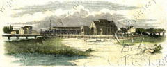
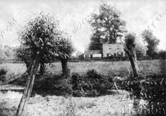
When the author penned these lines he may well have had local residents in mind; he knew the area well, for he was himself the son of the naturalist and writer Edward Jesse, who lived at one time at West Molesey. The Molesey that Jesse knew enjoyed a peaceful agrarian existence, the two villages combined nourishing less than a thousand souls. In fact, one writer in 1844, after rambling along the river Mole, extols the scene thus: 'near its termination we pass through the pretty rustic village of East Moulsey'. Two years later, however, an Act passed through Parliament, the effect of which (although it was perhaps not appreciated at the time) was for ever to shatter Molesey's pastoral tranquillity. This devasting piece of legislation was innocently entitled An Act to enable the London and South-western Railway Company to make a Branch Railway to Hampton Court Bridge in the County of Surrey. The most crucial date in the whole of Molesey's history was arguably 2 February 1849, for on that date Hampton Court station was opened which, besides bringing more and more daily visitors, precipitated Molesey into commuterdom. Before this, a few wealthy people had enjoyed the privilege of working in London and living comfortably in the country, but these were mostly either court or political office holders or rich merchants. Now the benefits of both worlds could be shared by some of the slightly less well off.
In an instant the fields and meadows, market gardens and groves, were eligible sites for desirable villas, and local landowners were not slow to recognise the golden potential of the asset on which they sat. The most successful of these was a Hampton lawyer and property developer named Francis Jackson Kent who, even before the railway line was opened, visualised the enormous possibilities for profit the land possessed. As early as March 1848 we find him negotiating the purchase of plots of land in East Molesey. By the end of 1850 he was the owner of all the land bounded by the river Thames, Hurst Lane, Walton Road, and Bridge Road, with the exception of that south of Keen's Alley, which was owned by the Arnison family and others, and the small Feltham estate near the lock. In all this comprised some 300 acres, for which he paid something like £60 to £80 an acre. Kent immediately set about laying down roads across the estate, which was eponymously named Kent Town — a name which even the Ordnance Survey adopted. Building plots were offered for sale along the roads, some of which realised over £4,000 an acre — quite an appreciation over his initial outlay. The land nearest to the station was quite naturally the centre of Kent's earliest sales. Here, firstly in Palace Road and then in Wolsey Road, large mansions were built, mostly with grand family rooms on the main and first floors, and quarters for the servants in basement and attics. Some were even complete with separate stables and coachhouses. For these were the homes only of the rich commuters, whose occupations — gleaned from the census returns were mainly as high grade civil servants or City merchants. To maintain the exclusivity of this area gates were positioned across the road at the entrance, which a porter was employed to open and close when required. His lodge still stands as No 1 Palace Road. However, it was obvious that the presence of this community would bring work for others: tradespeople, builders, gardeners, and so on, all of whom would need homes, as would, too, less well off commuters — clerks and the like. In December 1850, therefore, Kent sold off some 50 acres in the south-west corner of his property (in other words as far away from the gentry as he could get it) to an organisation called the Westminster Freehold Land Society, for £4,700. Now freehold land societies have an interesting history, originating in the political struggles of the disfranchised lower middle classes in the mid 19th century. The right to vote in parliamentary elections had for centuries been limited only to men who owned freehold property worth at least two pounds a year — the 'forty shilling freeholders' — although this had been extended to certain copyholders and leaseholders by the Reform Act of 1832. This property requirement tended, of course, to favour the Tory Party. The Liberals, therefore, promoted the freehold societies with the expressed intention of encouraging the emerging middle classes, mostly tradespeople and small business owners, who would be expected to vote Liberal, to qualify for the franchise by easing the path to property acquisition. The society bought the land, laid out the roads, arranged for the building of houses, and then loaned the money to their members for the intended purchase. By the enterprise in East Molesey, the promoters hoped to gain some 250 votes for the cause — which one Conservative newspaper thundered 'smacks of communism'. The passing of the second Reform Act in 1867 lessened the requirement for land societies, who then dropped their political aims and became the nascent building societies of today. The laying out of the Molesey property was left to two committee members, Henry Vine and William Pemberton, together with the Society's solicitor, George Edgar Dennes, in honour of whom some of the roads were named (Dennes Road was later corrupted to Dennis Road). The plan projected by these gentlemen contrived some quite fine class distinctions. It would not do in Victorian England, even among Liberals, for citizens with pretensions to mix with the working classes. Therefore, in Vine Road and Kent Road the houses to be built had to contain at least six rooms, have a value of at least £250 each, and have a building line of 25 feet from the pathway; those in Manor, Park, Pemberton, and Dennes Roads, to have at least five rooms, of value at least £150 each, and to be 15 feet from the pathway; those in Hurst Lane were obviously expected to house the lowest class, for here the houses abutted right on to the pathway, and the only restraint recorded was that no pigsty or stable or accumulation of manure or other offensive matter was to be allowed, without first erecting a wall or close fence next to Dennes Road at least six feet in height. These restrictions were clearly relaxed later, probably to allow more dwellings to be accommodated, as indeed was another, which said that no public house or beer shop was to be allowed on any part of the estate, for shortly afterwards the Europa Inn was built.
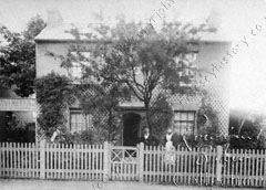
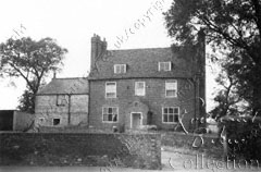
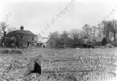
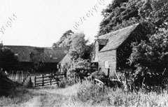
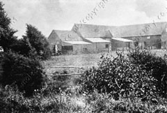
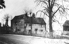
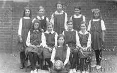
Woodbine Cottage, Pemberton Road, about 1880, Mr Ben Thompson, builder, standing by the gate. While all this was going on, the nibbling away of Molesey's fields and orchards was proceeding apace in other areas. Matham Road was laid around the grounds of the old Matham Manor House, which in a much truncated form had by then become a farm house. The houses here were also of high value and — like Palace Road — gates were placed across the entry with a porter and lodge house (No 36 Walton Road, which was still called 'The lodge' until a few years ago). School Road emerged across the rickyard of the old Priory Manor Farm. A market garden stretching from Manor Road to Bridge Road was developed by its owner, John Arnison, and his brother-in-law George Langley Hansler. The plot of land between the lock and the bridge, belonging to James Feltham, also disappeared under bricks and mortar. Shops started to appear in a long straggle all along the main road from Hampton Court downwards. The name of the main road had never properly been defined, different parts being called different things by different people, but in 1868 it was officially named as Bridge Road from the bridge to Esher Road, and Walton Road from there westward. The resultant influx of population is reflected in the census returns, which show that in the 20 years between 1851 and 1871 the number of people in East Molesey more than trebled — from 765 to 2,409. Such rapid growth could not be accommodated, and was not accommodated, without a certain amount of anguish. The newcomers bore no loyalty to the parish and its past. The original inhabitants resented the way the intruders had been thrust into their little community. In parochial affairs the village split into two factions, which became known as The Old Party and The New Party. Whatever one proposed, the other opposed, and vice-versa. Being of more or less equal numbers, things stagnated. Problems were manifested mainly in three particular issues, all of which were aggravated by the very expansion itself, and on which they ought to have made common cause — accommodation in the church, burial of the dead, and the provision of schools. In all of these cases the outcome was settled only by the two sides resolving to divide, a poor solution, the effects of which bedevil us even today. The church problem, after many years of squabbling, was determined only by the creation of two parishes, each with their own church — St Mary's and St Paul's — which means we are saddled today with two expensive churches to maintain, where one would suffice. The same solution evolved as far as schools were concerned. Everybody agreed that schools were necessary, but would not agree on joint action to provide them. Again each side built their own, and at the same time: St Mary's in School Road, and St Paul's in Park Road. Both opened in 1860. It was not until 1877 that the two schools undertook to unite, with one used for boys and the other for girls and infants, and then only because lack of funds threatened to close St Paul's. Only recently has the necessity of maintaining the fabric of two separate buildings and two separate sites been overcome by the erection of a new school — St Lawrence — in a more delightful location. It was, however, the last of the three — the provision for burials — that caused the biggest furore. By 1860 the small graveyard around the old church became full up, and an Order in Council was promulgated prohibiting any further interments. It had been realised for some time that this would happen but, because the two factions would not compromise, every attempt to provide a replacement was frustrated. For a time, surrounding parishes accepted bodies for burial in their own churchyards (in fact for two years there were more East Molesey people buried in West Molesey than there were locals), but soon these places said no. Their own graveyards, too, were becoming exhausted. The matter came to a head in 1863, when the three-month-old child of a poor man living in Bell Road died. The baby could not be buried in either East Molesey or West Molesey, so he applied to Thames Ditton and was refused; Esher said they would accept the burial for a fee of three guineas, which the father just could not afford. Still less could he manage to have the funeral at Brookwood Necropolis, the only cemetery available. What was he to do? He did the only thing possible in the circumstance — he buried the infant in the backgarden of his own house. This scandal and the uproar it caused jolted the parochial authorities to take action. Mind you, they still took over two years to do so. Eventually they settled on the purchase of a piece of ground in West Molesey, which was still only accomplished by the usual formula of division and demarcation. The plot had to be severed in two, and there were two burial boards, two clerks, and two sets of accounts to be rendered, one for each of the parishes. What a carry on! Meanwhile the deadly march of relentless development progressed along the road towards West Molesey. In 1876 East Molesey Park, whose grounds ran from the river Mole to Walton Road and from Bell Road to the Europa, came onto the market by the death of the Dowager Lady Clinton. The old house was demolished, and villa residences laid all over the beautiful landscaped park. Lady Clinton lived in Molesey for just 25 years, but has left a legacy making sure that her stay will be a long remembered one, in the names used for the roads on the estate. Her first husband was Lord Clinton, after whose death she married Sir Horace Beauchamp Seymour, and her step-daughter was the Countess Spencer (an ancestress of the Princess of Wales). Furthermore her maiden name was Poyntz, from which the nearby public house was named. Plans were passed in 1879 for Avern Road, and shortly afterwards Spreighton Road (originally spelled Spreyton, after a village in Devonshire from which the developer came); Langton Road and Grange Road followed around the turn of the century, almost joining the two villages together. The fields beyond West Molesey village, together with Molesey Hurst Golf Course, disappeared in the l930s. There had been five farms in the parish. Manor Farm had its farmhouse and yard in High Street, where Cannon Way now is. Its cultivated lands were further away on part of the Hurst and what later became the golf course. Island Farm occupied the land between the rivers Mole and Ember, most of which is now covered by the Island Barn reservoir. The farmhouse was at the corner of High Street and Priory Lane. Church Farm, the 18th century farmhouse of which still survives, lies between Walton and Hurst Roads. The John Nightingale School and the doomed Bishop Fox School now occupy the site, but what its future will be who can tell? Upper Farm stood on land to the south of Walton Road, opposite Church Farm. A small farm called Summers Farm occupied land now part of the Down Street estate, and originally part of Dunstable Common. This was low-lying and often waterlogged and unworkable for much of the winter, hence it was known as 'The Summers'. The farmhouse still stands.
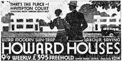
Advertisement for Howard Houses, 1934. Note the prices! Of the building estates which now occupy these acres, by far the most interesting is that built over Upper Farm, and called 'Howard Houses'. In 1933 an enterprising young estate agent — Donald Gordon Howard — then but 22 years old, conceived the idea of erecting houses inexpensively, in the new cult, a modern unfussy clean-cut style, with flat roofs, plain white walls, and steel-framed windows. The dwellings were constructed so cheaply that, even selling at a price of £395, with repayments of only 9s 9d a week, Howard anticipated making a clear profit of £100 on each. But even after a high-powered advertising campaign, proclaiming amongst other things 'a Suntrap Home on a sunlit estate in a neighbourhood visited for centuries as a show place and a beauty spot', and a huge painted display board on Waterloo station depicting the houses with Hampton Court Palace as a backdrop; even with refunded fares and a fast car from the station; even with an organised river trip from London to West Molesey; and even at this extraordinarily low price, after two years, when 320 houses had been built, only 100 had been sold. Inevitably Howard ended up bankrupt, but later carried on the development as the manager of a firm owned by his wife.
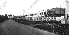
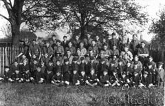
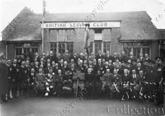
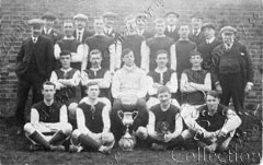
Howard Houses in construction, 1934. While all these bricks were being laid, the great innovations of the age gradually became available to the residents of Molesey — gas in 1851; piped water in 1871; a fire brigade in 1872; sewerage in 1894; the telephone in 1900, and electricity in 1904. Other activities, sports and social, also followed: a boat club, and three separate annual regattas; football clubs; cricket clubs; a hockey club; a women's hockey club (the first ever to be established anywhere); Oddfellows; Foresters; a horticultural society; a building society in 1852; a cooperative society in 1872; a working men's club in 1885; a bank (Ashby's, later Barclay's) in 1889, and a cottage hospital in 1890. We started with a quotation from 1844, describing Molesey as a 'pretty rustic village', and we end with another from 1910 which says 'East Molesey is an ugly suburban looking village'. In 66 years the despoliation was complete. |
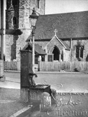
Parish pump, West Molesey, removed c1930.
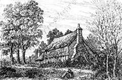
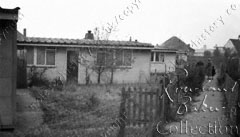
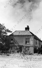
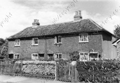
Benn's Cottage — foremerly standing at the corner of Walton and Kent Roads — demolished 1885.
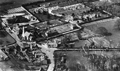
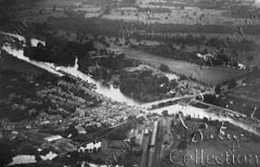
West Molesey from the air in 1926, before the area was developed.
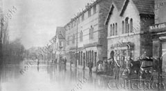
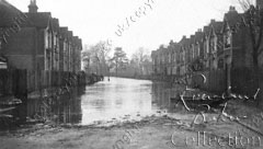
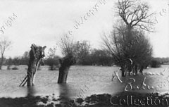
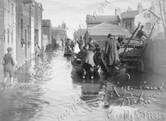
Grange Road in flood, probably 1928.
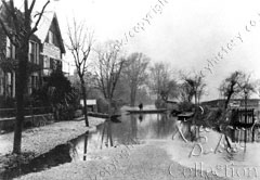
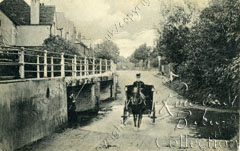
Looking across the river Ember to Esher Road, about the turn of the century.
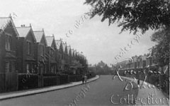
Langton Road, built around the turn of the century.
Old cottages in Esher Road, demolished early this century.
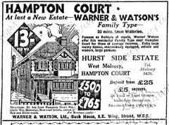
Advertisement for houses in Windsor Avenue and Balmoral Cresent.
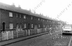
Municipal housing in Spreighton Road, built 1927, now demolished.
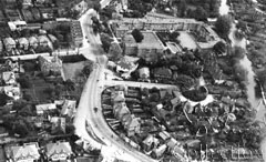
Bridge Road from the air, about 1948. Note the old Vicarage on the corner of Arnison Road.
|
|
ISBN 0 86023 251 4 The Book of Molesey was originally published by Barracuda Books, now part of Baron, publishers of heritage volumes - maritime, military, transport, sporting and local. It is made available here with the kind agreement of Radmore Birch Associates. Previous ChapterNext ChapterRelated Subjects: Printed version of this book:
A printed copy is available from:
|
All books copyright © R G M Baker, all rights reserved.
Images © 2006 M J Baker and S A Baker, all rights reserved.
Web page design © 2006 M J Baker and S A Baker, all rights reserved.